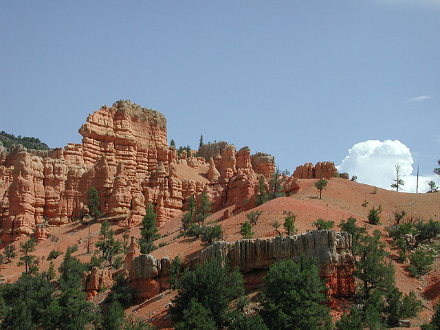

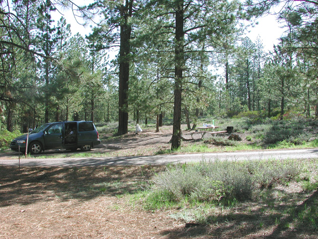
Red Rock Canyon Bryce Point Eureka Campsite
Four Corners
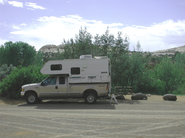
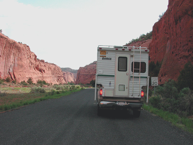
Between May 26 and June 12, 2003, our truck camper Harry carried us from Berkeley, California, through the spectacular canyon country of the Four Corners area where Colorado, Utah, New Mexico, and Arizona meet.
For enlarged photos, click on the thumbnails.
Heading east across the Sierra Nevada at Sonora Pass (Tioga Pass was still closed by snow), we followed a little populated route via Tonopah and Caliente, Nevada, to the Wasatch mountain front in southern Utah. The scenery became steadily more eye popping as we climbed rugged Cedar Canyon to the red-rock spectacle of Cedar Breaks National Monument.
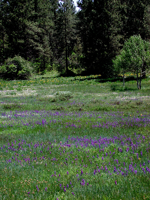
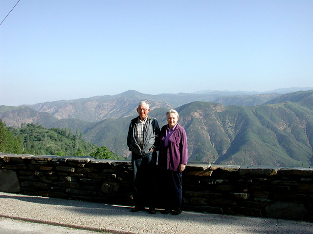
After camping at Panguitch Lake, we took in the even more impressive vistas of Red Rock Canyon and Bryce Canyon National Park. An earlier experience of Bryce had inspired Carolyn to entitle her first book The Death of Nature and we camped near the "Eureka!" campsite where the idea struck her.
Red Rock Canyon Bryce Point Eureka Campsite
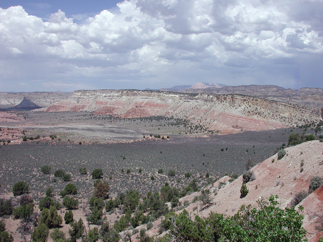
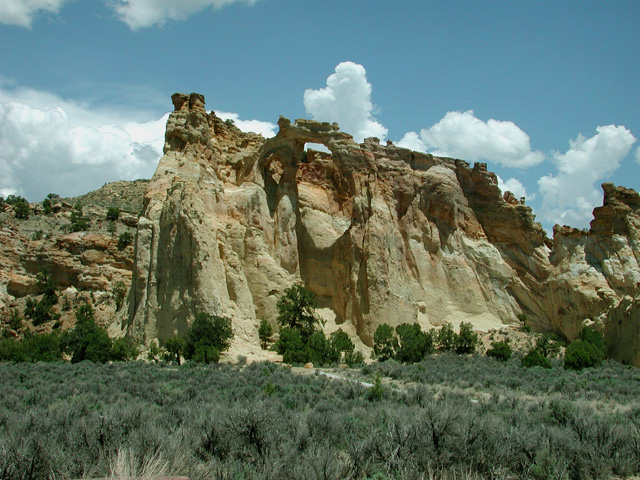
From Bryce we ventured into the backcountry of the Grand Staircase Escalante National Monument. To save this dramatic backcountry from development, Bill Clinton had to brave the fury of Utah politicians. Along unpaved Cottonwood Road, the highlight was the remote and impressive Grosvenor Arch. Returning to scenic Highway 12, we headed northeast through rugged mountains and canyons.
After camping and reprovisioning in the town of Escalante, we turned southeast on the celebrated Burr Trail, and arrived by mid-morning at the Deer Creek campground. This shady little streamside oasis was so irresistibly birdy (nesting Western Kingbirds, Bullock's Orioles, and Black-headed Grosbeaks among others) that we set up camp and spent the rest of the day hiking and birding.
The next day of backcountry travel was a high
point of the trip. The Burr Trail took us via Long Canyon to the brink
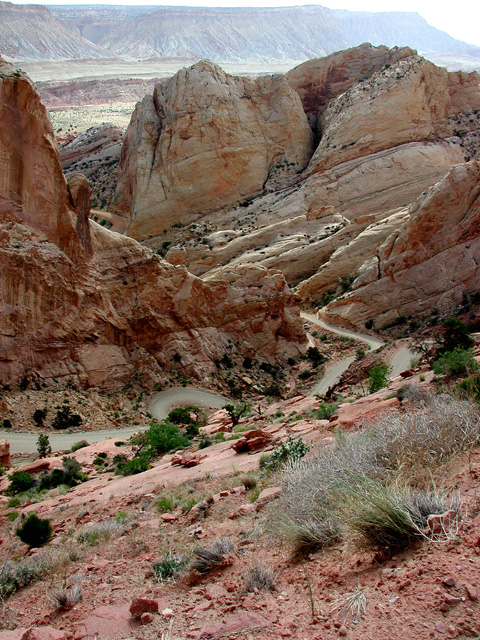
of the Waterpocket Fold, a deep north-south rift that is the central feature
of Capital Reef National Park. Looming beyond the Fold was the country's
last discovered and last named mountain range, the Henry Mountains.
At this vantage point, where protest had blocked further paving, we shifted
to four-wheel drive for the precipitous plunge into the Fold.

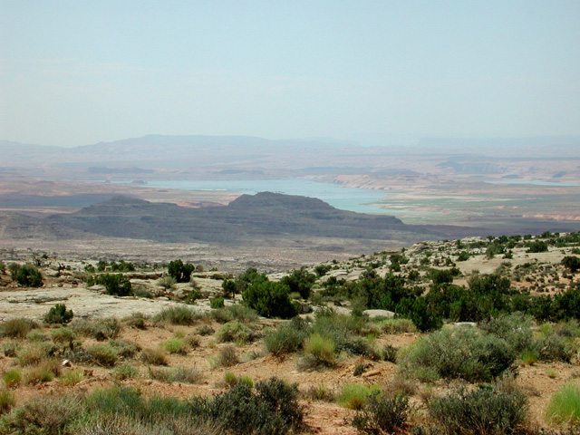
At the bottom of the Waterpocket Fold, the Burr Trail gave way to the Notom Road, which took us south along the Fold to more pavement and eventually to the Bullfrog Marina on Lake Powell in the Glen Canyon Recreation Area. Crossing this immense stone bathtub by state ferry amid houseboats, water skiers, and screaming outboards, we mourned the drowned wonders of the Colorado River's primeval canyon beneath us.
That night we camped amid pinyons and junipers at the Natural Bridges National Monument, and the next morning toured the stream carved bridges in its gooseneck canyons.
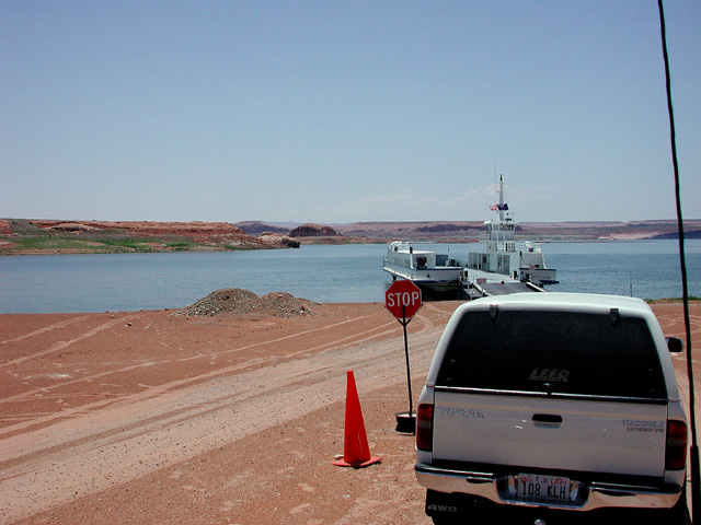
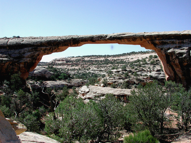
Lake Powell Ferry Owachomo Bridge
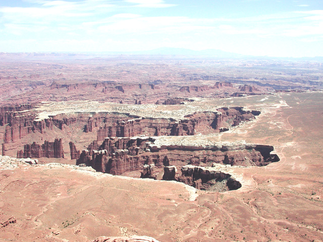
Leaving Natural Bridges, we again abandoned pavement
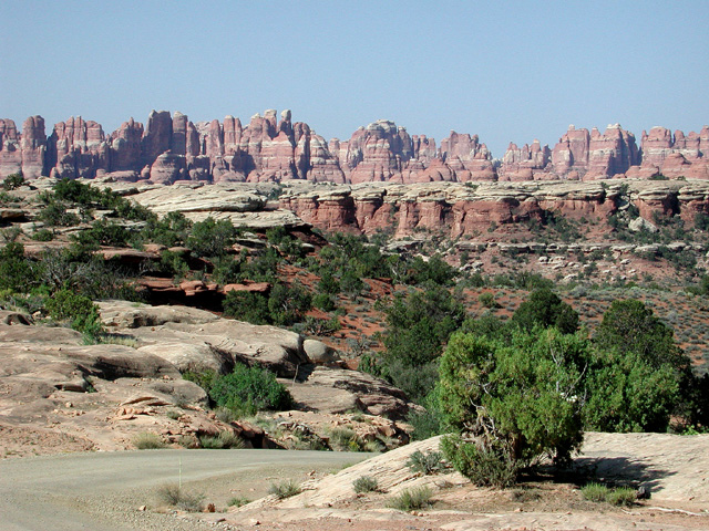
for a 65-mile Forest Service road north atop Elk Ridge toward the Needles
section of Canyonlands National Park. This route, often single-lane with
deep dropoffs and hairpin turns was a bit hairy even for Harry. But
we were richly rewarded with solitude, colorful vistas, a pondful of Common
Mergansers, and a growing profusion of wild flowers. Shortly after turning
west on the paved road to the Needles, a sky-scraping rock finger portended
the fabled wonders ahead.
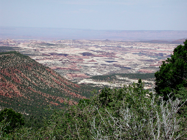

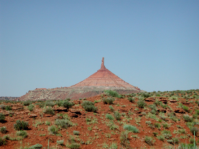
Elk Ridge Vista Opuntia The Finger
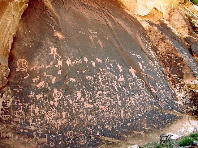
Our anticipation was further whetted that evening by the rocky grottoes of the Needles campground and the glow of wildflowers in the setting sun. But nothing quite prepared us for the prodigies of rock, color, and light we drank in the next morning. Pulled away from this spectacle by our need for RV hookups and reprovisioning in Moab, we were compensated en route by the profusion of ancient petroglyphs on Newspaper Rock.

The inspiration for our trip had been Edward Abbey's account of his experiences as the first ranger of the Arches Monument, before it was developed or much visited. Perhaps because he lambasted the National Park Service as an agent of "industrial tourism" in his classic Desert Solitaire, finding out where his trailer residence had been located required persistent inquiry. This unannounced and unmarked spot turned out to be graced by a public restroom serving a major attraction across the road, the Balanced Rock.
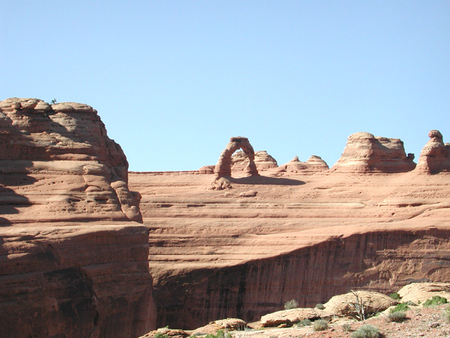
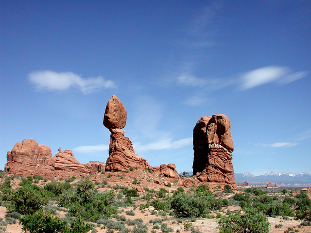
Canyonlands Delicate Arch Balanced Rock
The next stage of our trip took us to nearby western Colorado and the little mountain town of Nucla, founded by communally minded socialists, for a delightful overnight visit with good friends from Mexican birding caravans, Coen Dexter and Brenda Wright.
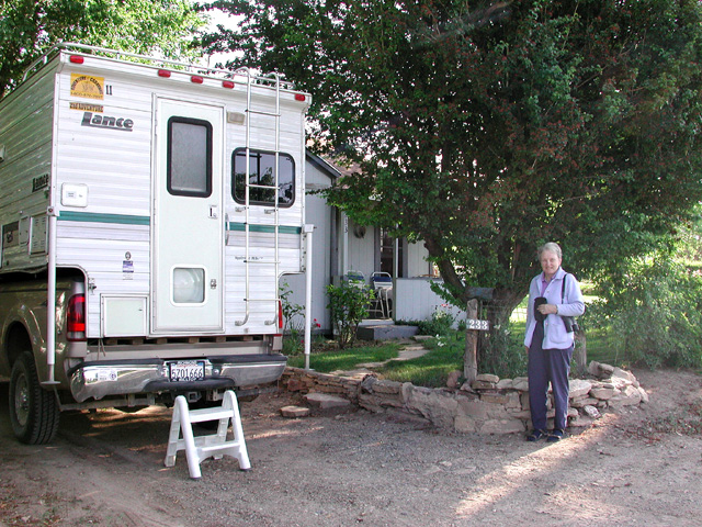
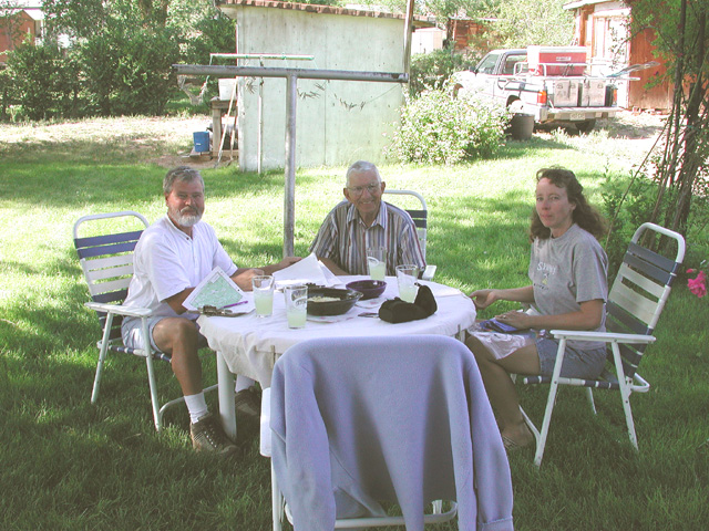
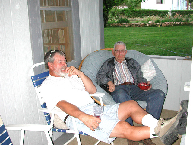
Harry and Carrie, Nucla Margaritas Guy Talk
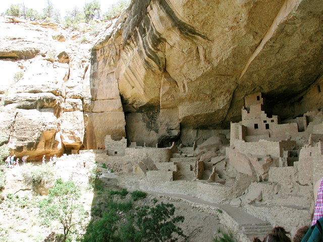
From Nucla, we took another unpaved Forest Service road south over the San Juan Mountains, where we particularly enjoyed great carpets of wildflowers. At Mesa Verde National Park, Carolyn photographed the cliff dwellings for her CD on American environmental history.

San Juan Flowers Lunchtime Carpet Cliff Palace
Turning homeward, we camped and hiked to ancient ruins at remote Hovenweep National Monument, lunched and camped in spectacular Monument Valley at Gouldings trading post, famous for its encouragement of Navajo crafts and archeology, and made a nostalgic detour to the South Rim of the Grand Canyon. Our last night in Arizona was at a picturesque campground in the dying little mining town of Chloride, where wildlife-feeding residents have tamed a host of rabbits, Gambell's Quail, Western Kingbirds, and Bullock's Orioles.
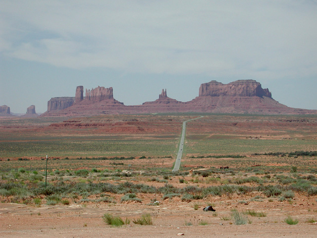
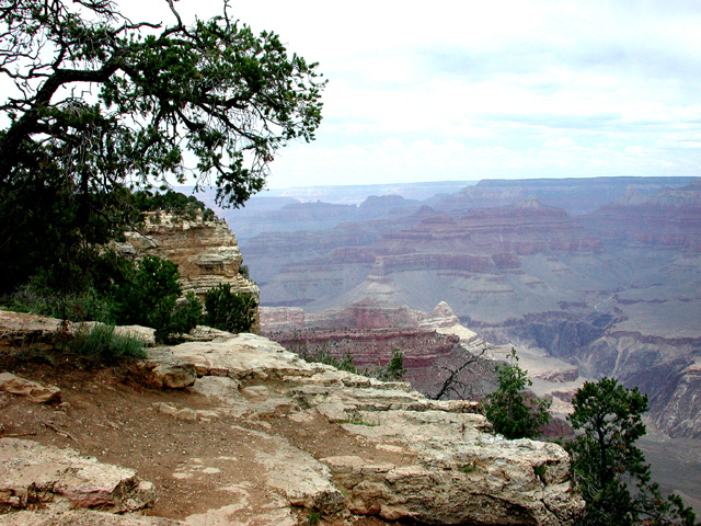
Monument Valley South Rim Dumping, Chloride
Back on fast roads, Harry sped us toward a final scenic hurrah in California's High Sierra. Reaching the jagged eastern escarpment of the snowy Sierra Nevada at Lone Pine, we followed it north to Mono Lake, turned west up fabulous Lee Vining Canyon on the Tioga Road, and entered Yosemite National Park by just-opened Tioga Pass at an elevation of 9945 feet. Beyond Tuolomne Meadows, still locked in wintry solitude, we paused to photograph Tenaya Lake. Here in 1853 a white militia force, after corralling the fleeing Yosemite Indians for expulsion from their beautiful homeland, ironically named this stunning alpine lake for the natives' Chief Tenaya. Around its horizon, under dramatic skies, soared Half Dome, Cloud's Rest, glaciered Mount Conness, and other notable landmarks.
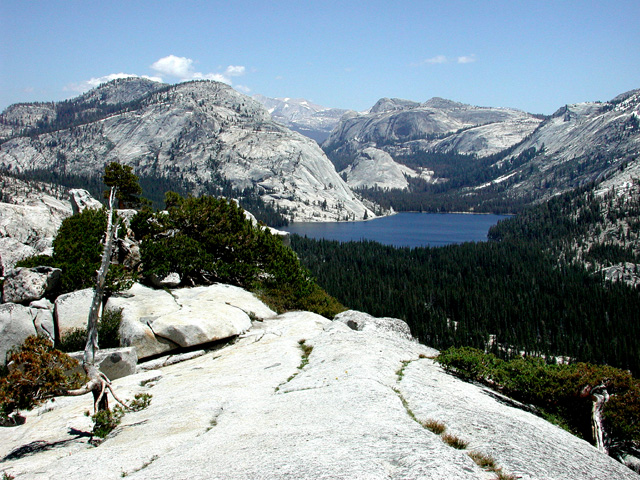
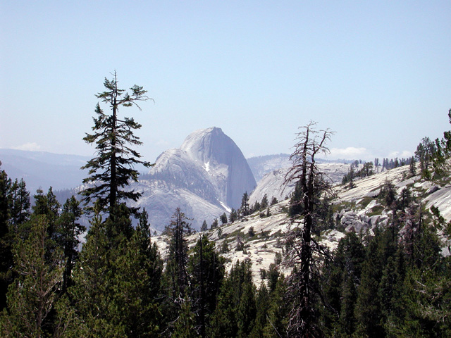
Tenaya Lake Half Dome
We made our last camp at Yosemite's Hodgden Meadow, and took our last photos the next morning at the lower canyon of the Tuolomne River. Here towering powerlines reminded us of environmentalism's costly defeat in the John Muir era, when the Hetch Hetchy Valley on the upper Tuolomne--comparable to Yosemite Valley on the Merced in Muir's estimation--was drowned by damming to provide water and electricity for San Francisco. A few more hours would bring us home to a congested Bay Area metroplex fostered in good measure by the rape of Hetch Hetchy.
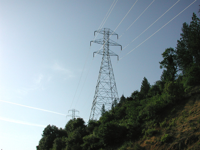
Hetch Hetchy Power
Homeward Bound
The End